

Methodological approach to the monitoring of the restoration of lands disturbed by the mining sector based on satellite data
- УДК: 622.012:[502.174:631.458:528.7]
S.P. Mesyats, S.P. Ostapenko
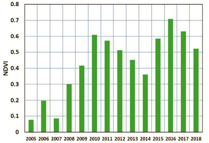
As ecosystems of nearly all geographic zones are exposed to technologyrelated effect, and the scale of this effect is global, the restoration of derelict lands is viewed today primarily as ecological restoration – restoration of natural ecosystems for sustainable development of the biosphere. The Mining Institute of the RAS Kola Science Center has developed a technology for restoration of disturbed lands of technology-related landscapes based on the principles of self-organization of natural ecosystems. The formation of biologically active environment by way of sown gramineous phytocenosis without a fertile layer applying provides rapid formation of a biogenous-humus-accumulating horizon and, as compared with self-organized vegetation, significantly more rapid formation of phytocenosis with the structure of the surrounding natural landscape. The authors propose a methodological approach to the monitoring of disturbed lands of the mining sector for their restoration based on satellite data.


")